
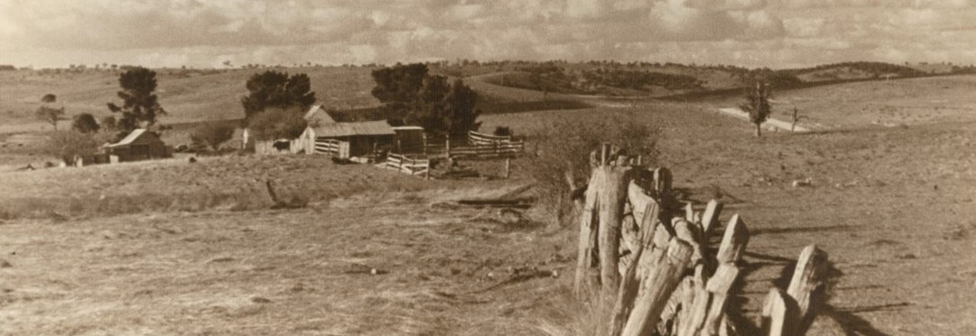
Villages and Localities
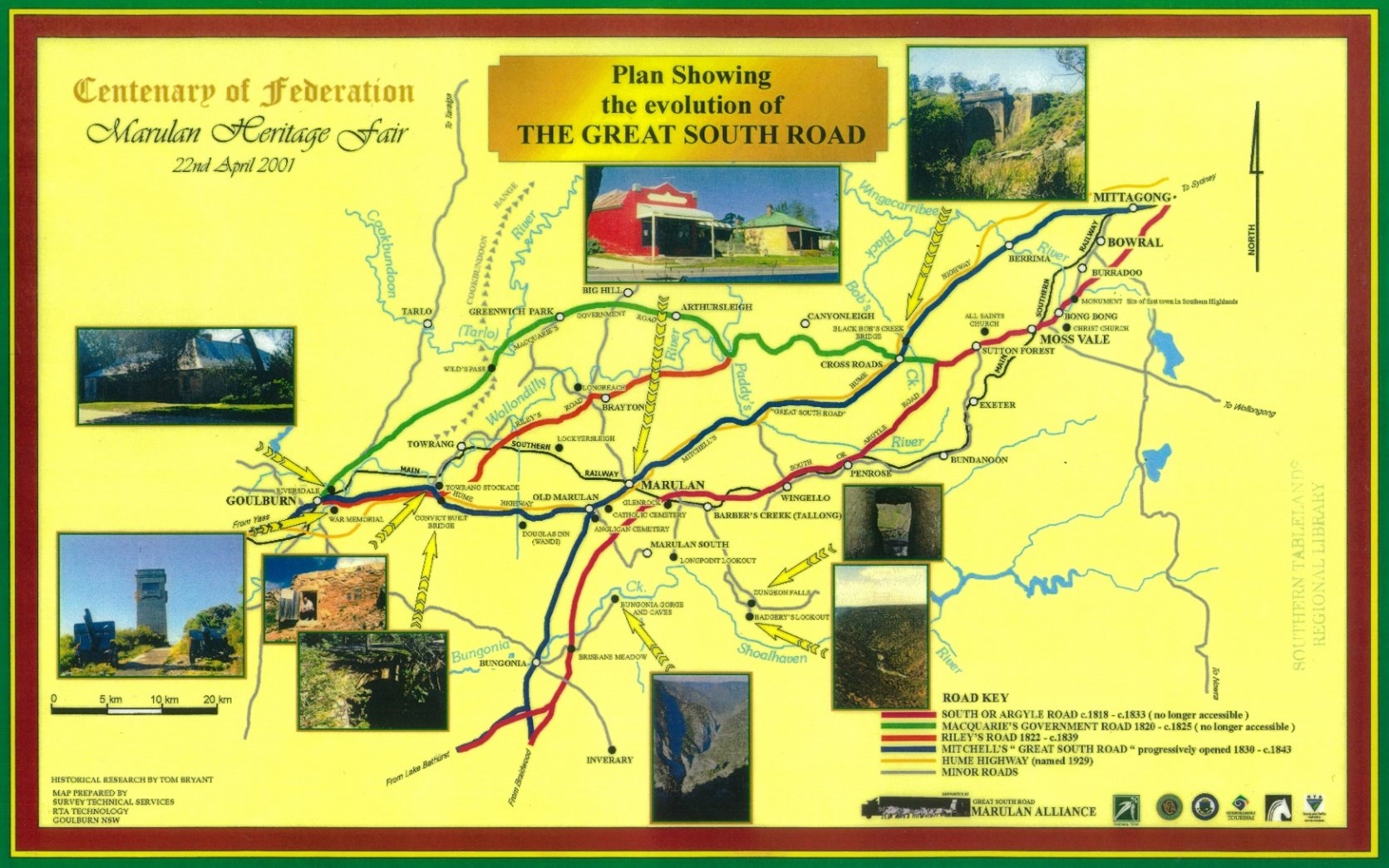
Plan showing the evolution of The Great South Road. PF-A3-8 no.13185.
The Goulburn Mulwaree Local Government area covers 3,220kms and contains many historic villages and localities. Some are still in existence today, but many have been lost over time. Here, local historian, Tom Bryant, delves into the area and highlights some of those places that, while not as big as Goulburn, still contain a lot of important history.
Tom is the author of many books that can be found in our collection, including the following: Some Windellama History, Joseph Peters, his Woolpack Inn and the Marian Vale Myth, and The Story of George Cole and “Cole Park”.
Bangalore (See Komungla)
Brayton
10km from Marulan on the road to Bannaby. It was formerly known as Longreach but was being confused with Longreach in Queensland so the name was changed in 1913. Possibly named after Lily Brayton, a movie star at the time. Brayton had a school from 1859 until 1953, a post office, and Joseph Peters had a hotel there from 1833 until 1836, when he transferred the licence to Old Marulan.
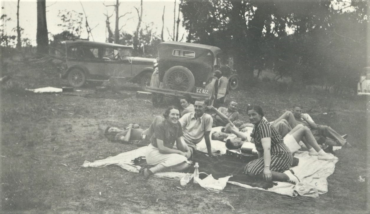
APEX Picnic at Brayton c1938. APEX Archives Album No. 1 no. 1374.
Breadalbane
A village on the Old Hume Highway south of Goulburn. Now, it has a school and church but formerly also had a hotel known as the Breadalbane Hotel, a service station, railway station, and an inn known as the Breadalbane Inn. The inn still stands as private home Sweetwood Lea.
Bronte
On Lumley Road between Bungonia and Tarago, formerly known as Mullengullenga. At one stage there was a school, Anglican church and telephone exchange (known as Glenoval).
Carrick
Located on the north side of the Hume Highway north of Goulburn. There was possibly a small village near the Carrick Railway Station, with a school from 1873 until 1909. The Railway Hotel operated from 1865 until 1870 to serve the workers building the Great Southern Railway. When the railway reached the area in 1869 the station was called Towrang, later to be called Mannafield and then Carrick.
Cullarin
A former village on the Old Hume Highway, south of Goulburn. It centred around the railway station that operated from 1880 and closed in 1973. It is also the highest point of elevation on the Great Southern Rail line from Sydney to Melbourne.
Cullulla
A locality between Windellama and Tarago formerly known as Curra Creek. There were extensive copper mines in the area.
Cullulla Homestead, Carina Clark, 2001. PF-A3-4 no. 760.
Currawang
On the northern shoreline of Lake George. Early settler, Francis Kenny, was granted 120 acres of land in the area in 1824, near a landform still known at Kenny's Point. A post office was established in 1859, followed by the school in 1867. Copper and gold were discovered nearby, leading to the development of two churches, shops, two hotels, a brewery, and a blacksmith. Both churches still exist today.
Currawang School c1900.
Jacqua
A farming locality on Oallen Ford Road between Windellama and Bungonia. At one time there was a school, telephone exchange and Anglican Church. Jacqua Reefs Gold Mines on the Shoalhaven River were nearby.
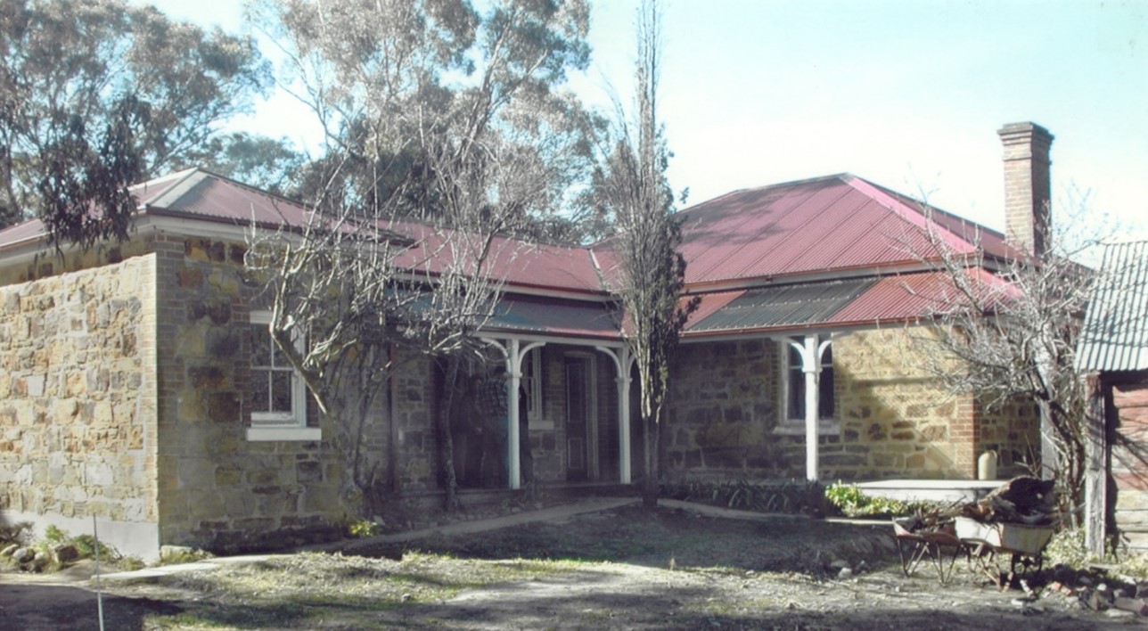
Kingsdale
On the Crookwell Road about 7km from Goulburn. There was a school from 1885 until 1948. The area had lime kilns, the remains of which can still be seen. There was also a hotel, The Kingsdale, which operated from 1884 until 1894. The building, now restored, still stands.
Kingsdale Farmlet c1950. PF-A2-3 no. 5639.
Komungla
A railway station originally known as Bangalore until about 1916, about 14km south of Goulburn on the Goulburn to Canberra rail line. It was closed in 1971.
Lake Bathurst
Officially founded in 1827, the village took its name from the lake nearby. The village was formerly called Tarago until that name was transferred to the present day village of Tarago nearby in 1884. From 1863 until 1887 there was a hotel known as the Tarago Hotel (later the Black Watch).
Lake Bathurst (the lake) was named after Earl Bathurst, Secretary of State of the Colonies in 1818. The first Christian service in southern NSW was held on the shores of the lake in 1820 by Colonial Chaplain Rev. Robert Cartwright.
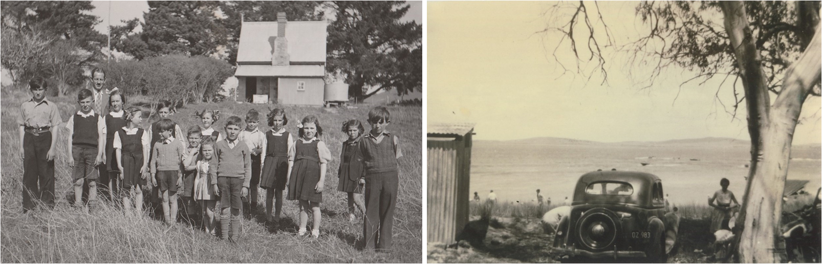
Left: Lake Bathurst Public School, c.1946, no.15001. Right: Lake Bathurst, photo donated by Colin Dennett.
Longreach (see Brayton)
Lower Boro
Located about 16km southeast of Tarago. Heritage listed Mayfield Homestead was built in the 1860s at Lower Boro, however archaeological remains on the site date back to the 1820s.
Marulan
When the railway came to the area in 1868 the new station was named Marulan, about 2 miles from the original village. Gradually everything moved to be near the railway station and a new village was established called Mooroowoolen after a nearby mountain of that name. Confusion reigned and in the Sydney Morning Herald of 4 December 1867, it was announced that “the railway would be opened to Marulan Station (at Mooroowoolen, about two miles from Marulan)'.
The new town around the railway station took the name of Marulan from 1 September 1878. There have been 4 hotels at Marulan, the Royal, the Terminus, the Duke of Edinburgh (later Golden Fleece) and the White Horse. The Terminus was named in 1865 as Marulan was the terminus of the railway at that time. It is still operating today.

Left: Terminus Hotel, photo by John Immig, March/April 2005, PF-12 no.2648. Right: Royal Hotel, George Street, Marulan, photo by Jackie Ranken, 25/4/1996, PF-47 no.9096.
Marulan South
Commercial production of limestone began in the 1920s at South Marulan and a company town was established around the works. Besides houses for the workers there was a store, post office, school, community hall and a bowling club. The village has now closed and all buildings have been relocated or demolished.
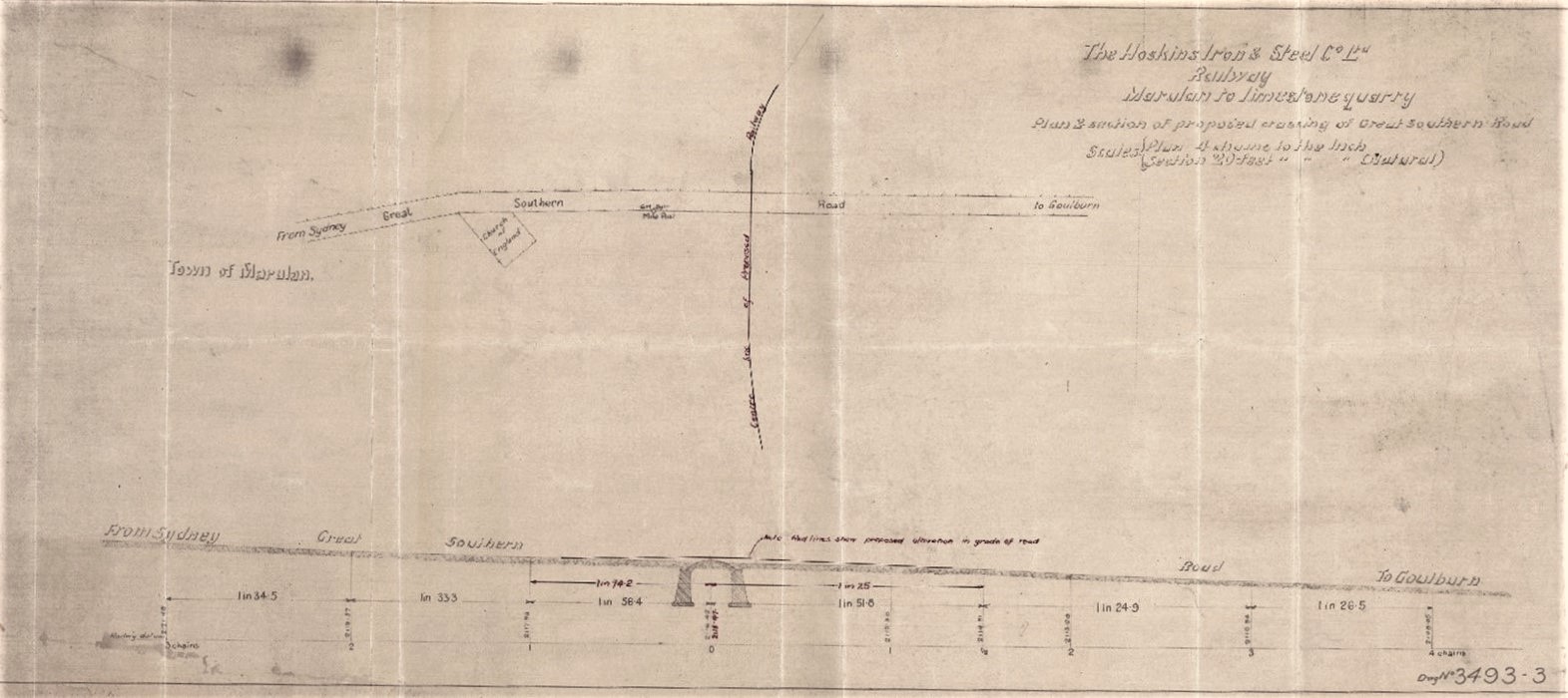
Railway from Marulan to limestone quarry. Plan and section of proposed crossing of Great Southern Road, Hoskins Iron & Steel Co. Ltd.
Mummel
A locality about 23km northeast of Goulburn on the road from Goulburn to Grabben Gullen. There were various schools in that area with names of Mummel, Pomeroy, Merilla, Mummel East and Mummel Lower from 1868 to 1959. There was a hotel in the area called the Rockfield.
Old Marulan
When the Great South Road (now Hume Highway) was surveyed in 1829 it superseded the old roads. The new road would go to Goulburn and beyond with a spur road to the Bungonia area that was then called Inverary. A new junction of the roads was set at a marked tree 3 miles (5km) from Barber’s Station (Glenrock). This was the location where the new town of Marulan (now called Old Marulan) would be situated, located where the Jerrara Road overpass crosses the highway about 5km from present day Marulan.
The village was drawn up in 1833, and one of the first portions of land was bought by Joseph Peters where he established his Woolpack Inn in 1836 having transferred his licence from the old Woolpack Inn on the old road to Goulburn (now known as Riley’s Road or the Carrick Road). At Old Marulan there was a post office, churches, a store and 3 inns, the Freemasons Arms (later Coach & Horses), the Woolpack (later the Black Horse) and the Golden Fleece. Today nothing of the village remains.
Parkesbourne
Off the Hume Highway just south of Goulburn. The name was suggested by Sir Henry Parkes who visited the area in 1868. The first settlers to the area were John and Ann Brown and soon after Henry Bugg. A dance hall opened in 1938, and the school operated from 1870 to 1969, known as Breadalbane Plains School from 1870 until 1874. There was also a shop and Post Office.
Quialigo
A locality about 25km south of Goulburn on the road to Windellama. There was a state school from 1871 until 1924, operating at various times as a 'half-time' school. Half-time schools were very small primary schools in remote and sparsely populated rural areas, sharing an itinerant teacher who would travel between two schools in the area for a few days each week. Half-time schools were generally single room slab timber buildings with shingle or iron roofs and earthen floors.
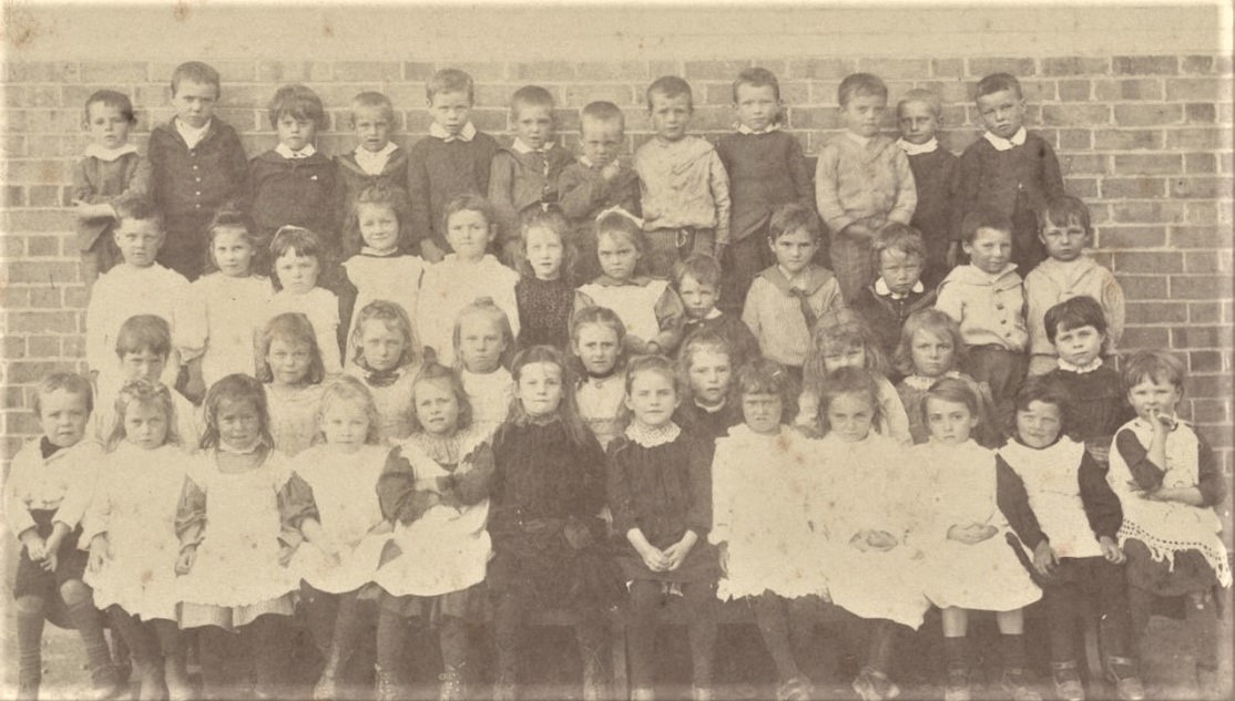
Tallong
A village on the Old South Road (now Highlands Way) to the north of Marulan. Tallong was originally known as Barber’s Creek, named after George Barber who owned the property Glenrock nearby. Renamed Tallong in the early 1900s, after an Aboriginal word meaning 'spring of water', the area was originally explored in about 1818-1820. The district's early development owes a lot to the hard labor of convicts, with some of their constructions still surviving today.
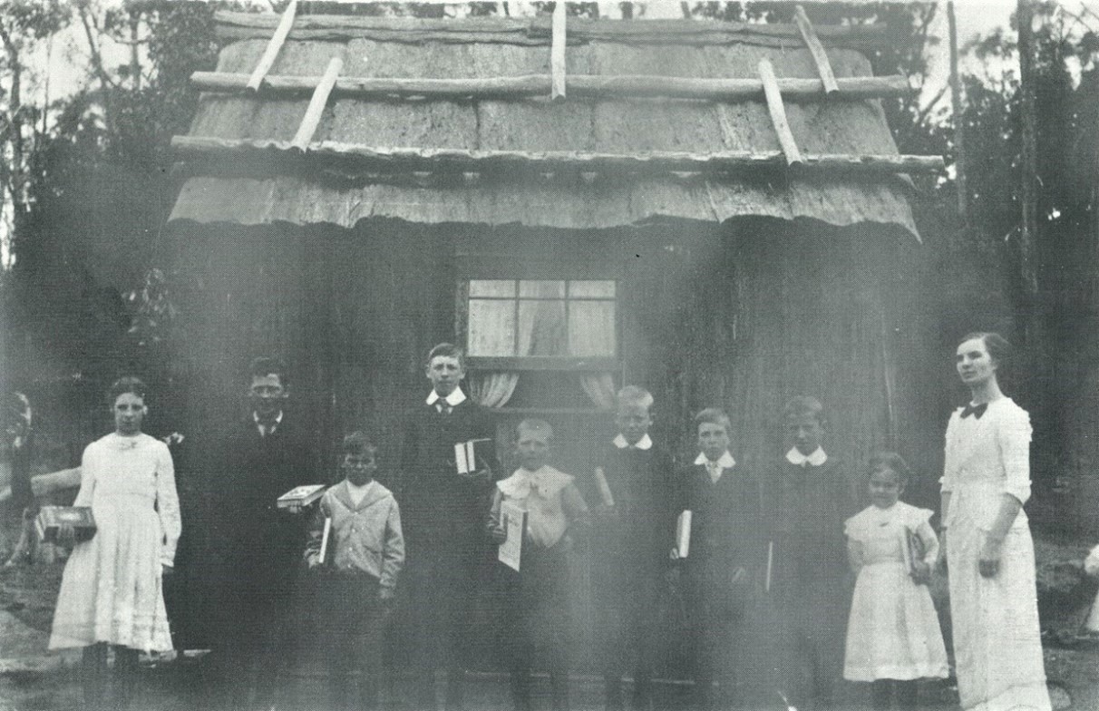
Tallong School or Caoura Provisional School, c.1900. PF-10 no. 2215.
Tarago
Tarago was officially founded in 1827 and was originally known as Sherwin Flats after a local landholder. When the railway to Cooma reached the area in 1884 the village took the name Tarago from the settlement now known as Lake Bathurst 7km to the north. Tarago was situated on what was, at one time, the only road into the Canberra/Queanbeyan valley, and as such was quite a busy centre boasting two produce stores, bakeries, Cobb & Co stables, a general store, and post office. The Lake Bathurst Hotel, now known as the Loaded Dog, is still operating today.
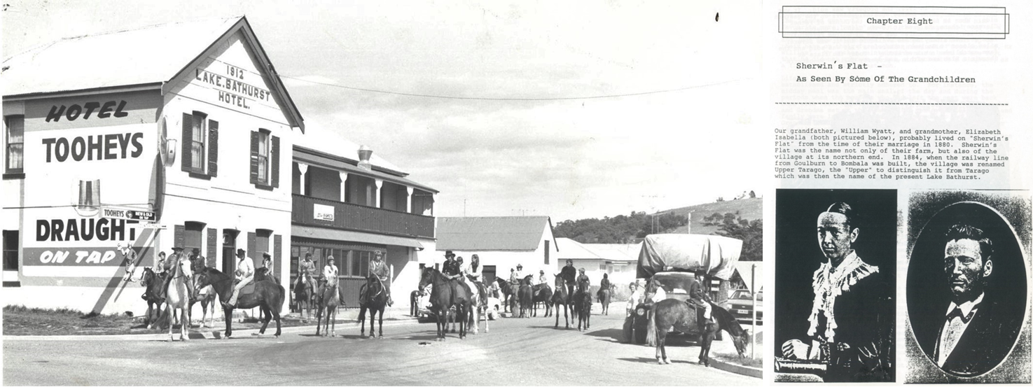
Left: Lake Bathurst Hotel, Tarago, Goulburn Evening Post, PF-21 no. 4030. Right: A page from the book 'The Sherwin’s Flat Wyatts', 2nd edition, 1991, available in the Library.
Tirranna
Located 11km south of Goulburn on the Braidwood Road. When James Meehan passed through the area on his tour of discovery in 1818, he passed close to where Tirranna is today and a hill in the area still bears Meehan’s name. It is said Meehan ascended the hill and viewed the countryside.
Andrew Gibson was granted land there in 1835 and he called it Tirranna, although it is sometimes referred to as Tirrannaville. A nearby land grant for the settlement of war veterans is referred to as Veteran’s Flats.
Reference has been found to gold fields and iron mines at Tirranna. There was also a Tirranna Picnic Race Club established about 1855 and closed about 1930. It was possibly on the property of the Gibson family. A hotel, The Pelican Inn, operated near Tirranna from 1860 until 1892. It is now a private home. The school has been in operation from 1869 to the present day, and the Tirranna Church opened 1860.
At one stage there was a toll house on the road where travellers had to pay a fee to proceed. The toll varied from one penny upwards for horses, sheep and cattle.
Wingello
The original Wingello settlement, from the Aboriginal word 'to burn', was on the old Main South Road several kilometres to the west of the present village. Construction of the Main South Road began in 1834 using convict gangs in irons, who built a stockade at Wingello, accompaned by a detachment of troops, constable's hut, and lock up. The road gang was moved to Towrang Stockade in 1838. The Wingello stockade was purchased by Thomas Brown in 1844, who built the White Horse Hotel on the site.
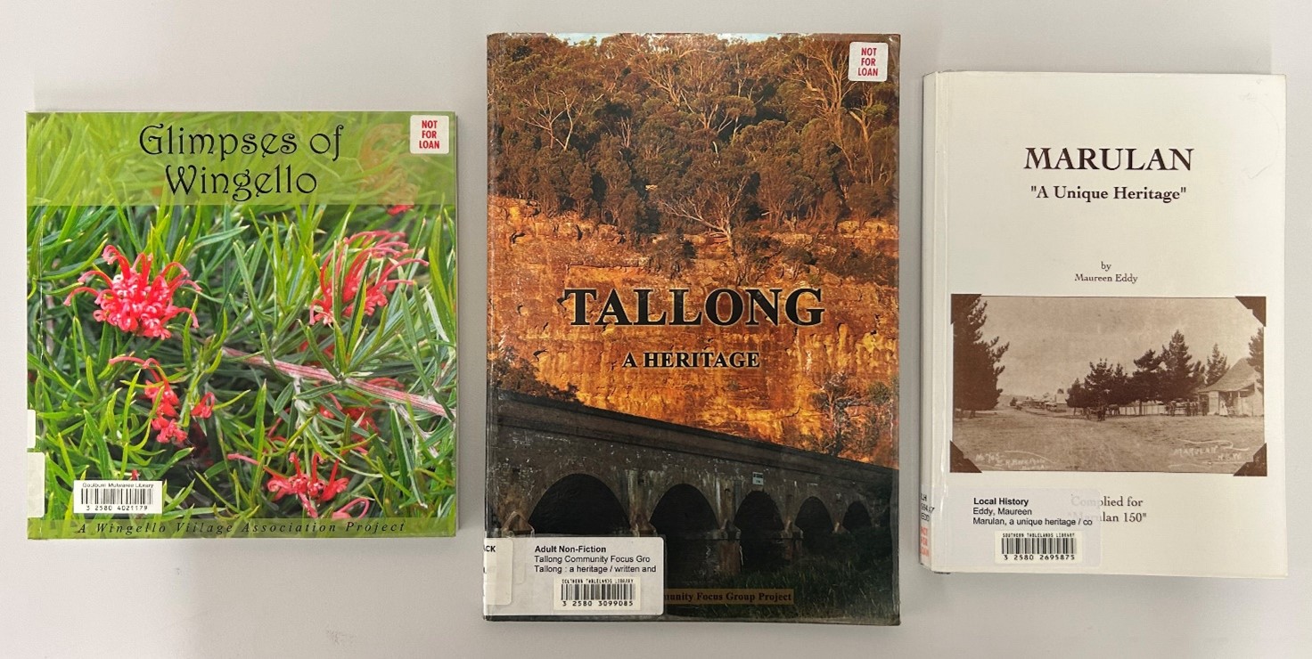
Some of the village books available in the Library.
Woodhouselee
Woodhouselee was possibly named after an early settler, but more likely was given the name by William Lithgow after a small town in Scotland. Woodhouselee railway platform, on the now disused Goulburn to Crookwell line, operated from 1902-1975, and the school from 1877 until 1893.
Yarra
Located 10km south of Goulburn on the Hume Highway. Formerly a railway station on the Great Southern Railway. The Traveller’s Rest hotel operated in the Yarra district from 1860 until 1875.
Yarralaw
Farming area on the Oallen Ford Road between Windellama and Bungonia. Originally there was a land grant of that name after which the locality took its name.
The Library has a fantastic range of primary and secondary resources on the history and development of our surrounding villages and homesteads. Get in touch with us today for help with your research or family history enquiries.