
Maps
The Library holds a range of historical town, parish, and county maps, as well as plans and sketches. These maps are useful to family historians and researchers looking for details of their ancestor's land holdings or movements at a given time.
Search for Maps
- Enter your keywords in the search box to find maps and plans.
- To browse all maps and plans, enter 'map' in the search box.
To view maps in the Library or get copies, please contact us.
Historical Maps of Goulburn
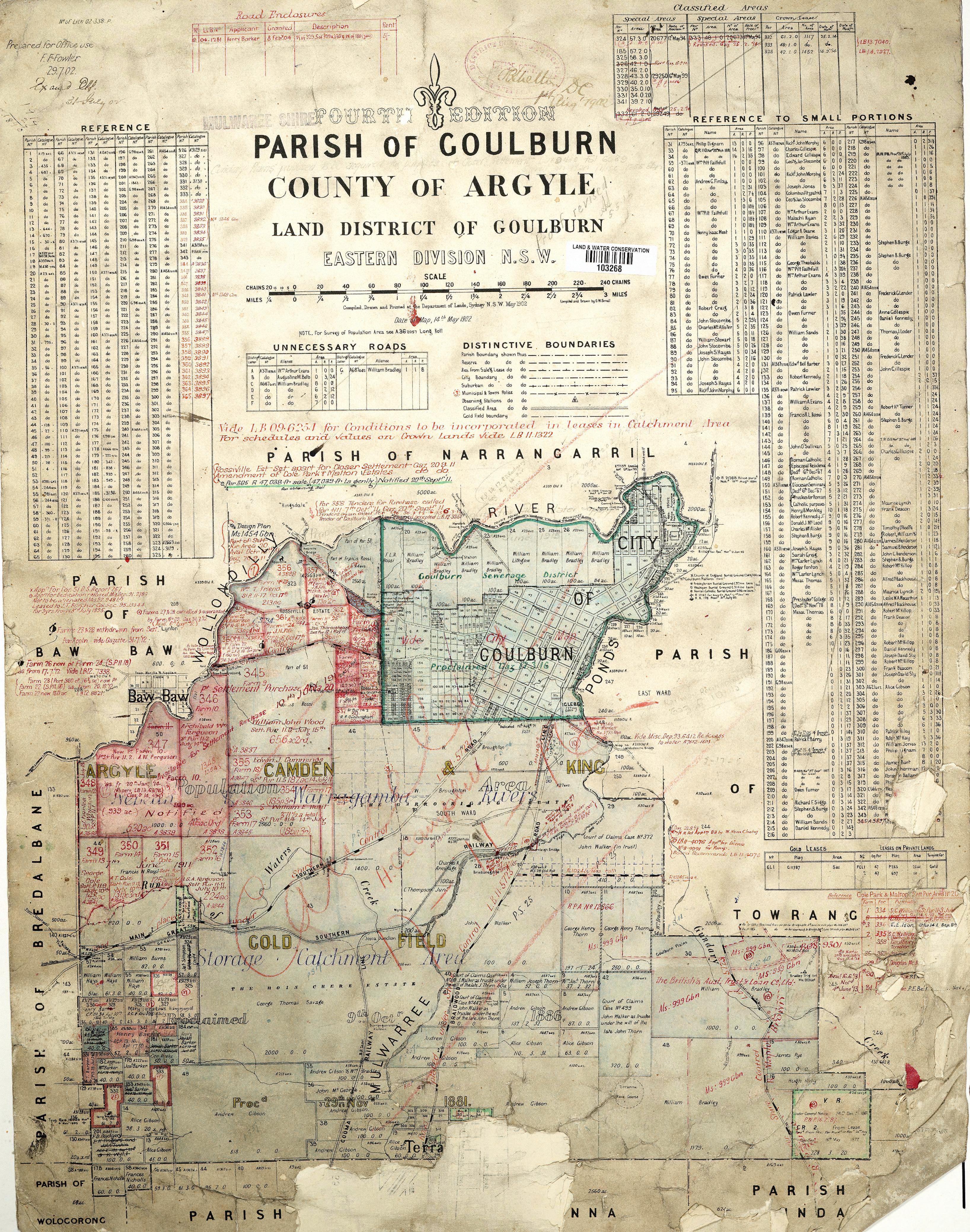
The Library holds a number of digitised historical maps of Goulburn:
- Plan for the town of Goulburn, 18 July 1833 / transmitted to surveyor Hoddle in the Surveyor's General Letter 33/m/. Enhanced by the Central Mapping Department of NSW
- City of Goulburn, bird's eye view, 1882 / supplement to the Illustrated Sydney News, September 1882
- Town Map, City of Goulburn, 1882: part 1
- Town Map, City of Goulburn, 1882: part 2
- Parish Map, City of Goulburn, 1902
- Town Map, City of Goulburn, 1914
Map Warper
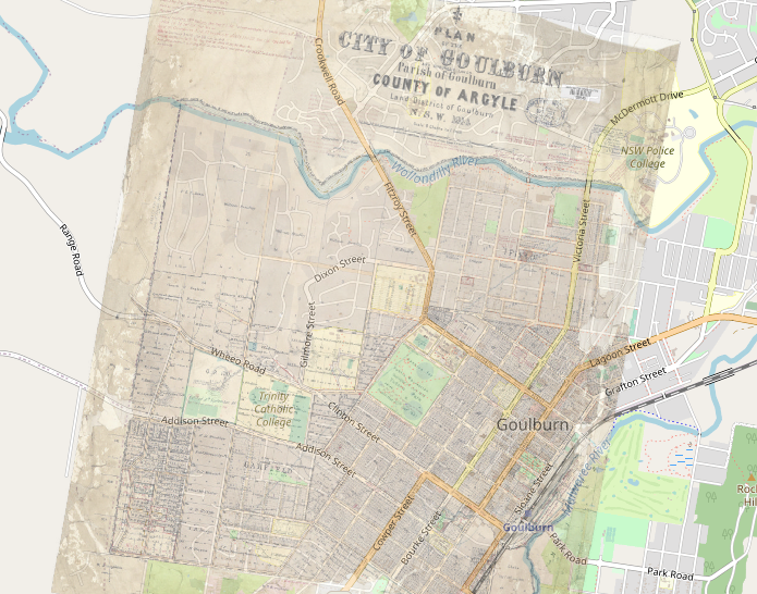
Map Waper is an image and map georeferencing service to 'warp' or stretch a map to fit on real world map coordinates.
The Library's 1914 parish map of Goulburn can be seen in reference to current map coordinates. See how Goulburn has grown and changed over time, how parcels of land have been divided, and compare our streetscape from 1914 to today: Goulburn 1914 Map Warper
See the full list of warped historical maps: